 Robert Brookman has seen plenty of storms over the last two decades from his modest home on Cecil Road in Port St. John.
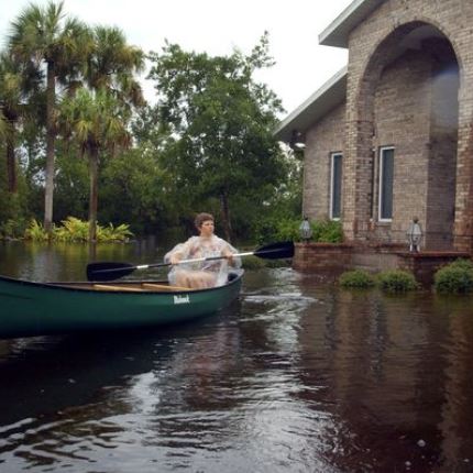
One storm in particular, he remembers, brought 11 inches of rain in seven hours.
But nothing prepared him for the tempest he felt after opening a letter from the Federal Emergency Management Association earlier this month. FEMA’s new maps for Brevard put his house in a higher-risk flood area and he now would be required to fork out $5,830 in flood insurance. That’s $485 a month vs. the $400 annually he had been paying for flood insurance.
“This was totally ridiculous,” said Brookman, noting his neighbors across the street are at lower elevation but they were not included in the higher-risk flood zone.
“I could lose my house because this expense is unfeasible,” he said.
Brookman isn’t alone in his distress. After FEMA’s new flood maps for the Space Coast became effective March 17, the agency has been notifying lenders and homeowners of a property’s new status when it comes to paying flood insurance premiums. Those suddenly in higher-risk areas, like Brookman, now face paying substantially more money each year for flood insurance.
Others are more fortunate and have been taken out of high-risk areas.
Property owners, engineers, surveyors and others, though, are finding a few problems with the updated maps, with some areas being placed in higher-risk flood zones for the first time, while others have been left off.
It’s too late to make any wholesale changes on the maps, officials say, so FEMA will work with property owners on a case-by-case when they become aware of potential errors and are presented with evidence, usually from a land surveyor. Adjustments can be made but it forces the property owner to initiate the proceedings.
“There are always problems when they redo the maps,” said Larry Larson, a senior advisor to the Association of State Floodplain Managers. “They map yesterday’s flooding. They don’t map future conditions.”
At stake are billions of dollars in annual flood premiums pouring into FEMA’s coffers. Also impacted are local real estate sales. Suddenly tacking on several hundred dollars a month in flood premiums would most likely lead a buyer to re-consider purchasing a property.
The flood map changes come about two years after the Biggert-Waters Flood Insurance Reform Act of 2012, which led to tens of thousands of property owners facing premiums that jumped 10-and 15-fold.
Biggert-Waters supporters said the increases were necessary because the flood premiums had been artificially low and that meant, in effect, that taxpayers were subsidizing insurance on those high-risk properties, including second homes or vacation properties.
Even after Congress earlier this year promised to temporarily rollback the reforms in Biggert-Waters, following harsh criticism, many homeowners still are looking at steep increases due to the new flood maps.
Brevard’s flood maps were more than two decades old when the effort was made to update them. Two years ago, officials began using what’s known as Light Detection and Ranging (LiDAR) technology. LiDAR measures topology by illuminating the ground with laser pulses.
FEMA also used newer and better flood models, which enabled them to incorporate more precise data about the flow of water in Brevard, and to establish new Base Flood Elevations countywide. The new maps are over laid on an aerial photograph.
As advanced and updated as that system is, it still didn’t get everything right, said Tom Holley of Holley & Associates, a 49-year-old land surveying company based in Titusville.
Holley goes to people’s properties and conducts elevation surveys. If it’s clearly in a lower-risk area after he has completed his surveying, Holley will issue an elevation certificate that property owners can use in an appeal to FEMA to get removed from the high-risk area. The appeals process takes two to three months.
“The last few weeks I’ve probably issued about 30 elevation certificates when I used to do 10 a year,” Holley said. “There are just some problems with the new maps. In some cases the zones didn’t hit where they were supposed to.”
Also not getting a rest from phone calls is Frank Skarvelis, Brevard County’s Floodplain administrator.
There were numerous changes, along with outreach programs, for property owners to look at the preliminary maps and address any concerns. Many didn’t look at those maps and now that the notices are being mailed out, they’re calling his office.
While many properties were taken out of the high-risk flood zones — Skarvelis’t have an estimate of how many — some beach side condominiums are hiring professional engineers to provide a data for an appeal to FEMA. Unlike single-family residences, condos and other properties need much more than an elevation certificate when making an appeal to FEMA.
“There are a lot of people scrambling now who own beach side and beach front condos,” Skarvelis said. “Flood insurance premiums go up dramatically when you’re in a costal high-hazard area.”
Brookman, a disabled Navy veteran on a fixed income, paid Holley $150 for an elevation study and Holley is pretty confident FEMA will reverse its decision on the property.
Brookman is hopeful. While not happy with having to payg $150 for an elevation survey, “It’s a lot better than $485 a month,” Brookman said.
Did you know?
Congress created the National Flood Insurance Program in 1968 to offer flood insurance to homeowners, renters and business owners.
The program is administered by the Federal Emergency Management Agency, which works closely with nearly 90 private insurance companies to offer flood insurance to property owners and renters.
To qualify for flood insurance through the program, a community must join the NFIP and agree to enforce ordinances that meet or exceed FEMA requirements to reduce flood risk.
Source: Florida Today